Construction & Engineering
How are drones used in this industry?
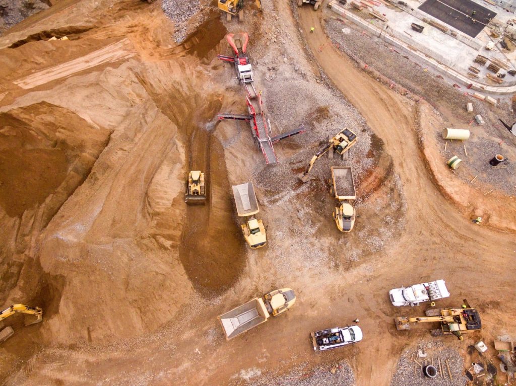
In the past decade, the use of drones in construction and engineering projects has surged. Drones offer invaluable assets that were once expensive, time-consuming, or even impossible to obtain. Services such as surveying and mapping, inspections and monitoring, progression documentation, quality control, and communication can greatly enhance any worksite.
Drones also offer significant PR advantages for the construction and engineering industry. Providing communities with updates on large projects helps maintain a positive image. With precision flight paths and autonomous technology, drones can create stunning construction timelapses, “before and after” footage, and impressive comparison shots. To discover the specific benefits Flight Film can bring to your project, read further down this page or consult with us today!
2D MAPPING
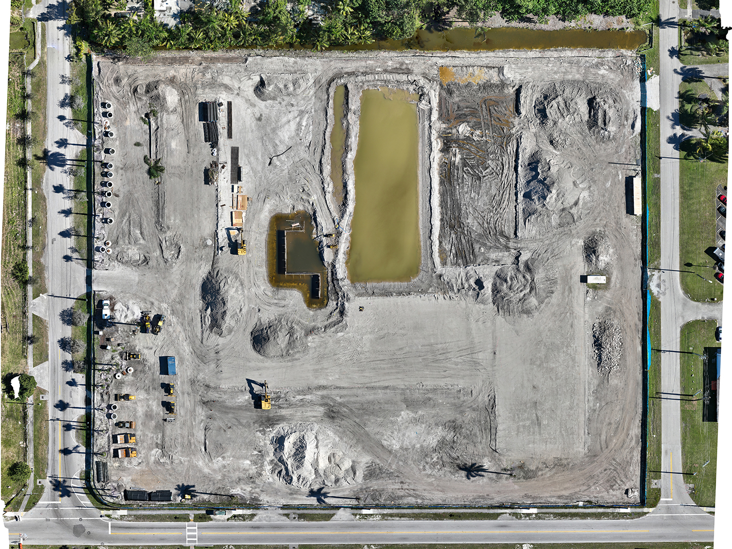
2D maps created by drones or other aircraft, known as orthomosaics, are formed by stitching together multiple high-resolution images. Drones can produce highly accurate orthomosaics and elevation models that cover hundreds or even thousands of acres of diverse terrain. Orthomosaics are distinguished from panoramic photos by two key characteristics: georeferencing and orthorectification.
Georeferencing links an aerial photo to actual coordinates on the Earth’s surface using GPS data, Real-Time Kinematics (RTK), and Ground Control Points (GCP). Orthorectification is crucial for map creation as it corrects distortions caused by various factors during data collection. This process ensures the orthomosaic is accurate and complete, providing a “straight-down” view with no warps, gaps, or inaccuracies in the data.
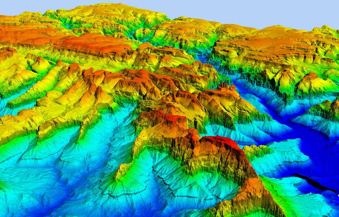
ELEVATION MODELS
A Digital Surface Model (DSM), shown here on the right, offers a unique visualization of extensive surface areas. The creation process of a DSM is similar to that of an orthomosaic, capturing 3D data from hundreds of orthorectified 2D images. DSMs enable quick understanding of a site layout by visualizing the elevations of different surface elements through simple graphical color representations. Rooftops, tall buildings, roadways, stockpiles, hills, valleys, trees, towers, and other structures are easily identified from a sitewide orthomosaic when referenced to a DSM.
Urban planning and development are greatly enhanced by incorporating DSMs into the planning and design phases of projects. Urban planners can analyze existing structures and see terrain contours that might be imperceptible from the ground or visual RGB orthomosaics.
